Updated 02/04/2026
Tennessee’s road network includes everything from major interstates to rural highways that cut through hills and farmland. These roads serve millions of drivers every year, such as commuters, freight trucks, tourists, and local residents. But some stretches stand out for a different reason: a consistently high number of fatal crashes. Factors like high traffic volume, speeding, limited visibility, or challenging terrain can all contribute to these dangerous patterns.
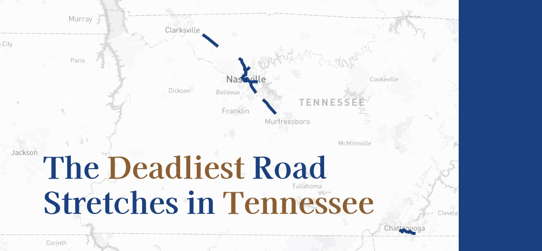
To better understand where fatal crashes are most concentrated, we analyzed five years (2019–2023) of data from the U.S. Department of Transportation, National Highway Traffic Safety Administration (NHTSA). We focused on identifying the 10-mile stretches across the state with the highest number of deadly collisions. Below, we break down which road segments ranked as Tennessee’s deadliest.
Key Takeaways:
- The deadliest road stretch in Tennessee is on I-24, running from near the Nashville International Airport toward central Nashville. This segment recorded 35 fatal crashes over the five-year study period.
- Of the ten deadliest road segments identified, four are on I-24, four on I-40, one on I-65, and one on I-240.
- By metro area, five stretches are located in or near the Nashville metro area, three in Memphis, and one each in Knoxville and Chattanooga.
Table of Contents
- What Metro Area Finds the Deadliest Road Stretches?
- Interactive Map of Tennessee’s Deadliest Road Stretches
- Methodology
What Metro Area Finds the Deadliest Road Stretches?
The table below lists the 10-mile sections of highway in Tennessee with the highest number of fatal crashes from the past five years, along with their closest major metro area.
Most of the road stretches on our list are located near Tennessee’s major urban centers. Below, we take a closer look at the top-ranking segments found in or around the metro areas of Nashville, Memphis, Knoxville, and Chattanooga.
Nashville
The top-ranking 10-mile stretch for fatal crashes is on I-24, a major interstate running southeast to northwest across Tennessee. This segment begins near the Spring Street interchange and continues southeast toward the Mill Creek Greenway Trail. The entire stretch lies west of Nashville International Airport and recorded 35 fatal crashes over the five-year study period. I-24 is a heavily traveled route connecting suburban and urban areas, and congestion is common, especially during rush hour.
Two additional I-24 segments near the Nashville metro area also made the list, both tied for 8th place with 16 fatal crashes each. These stretches are located north of the city.
The second-ranking stretch is on I-65, a major north–south corridor that passes through downtown Nashville. This 10-mile segment runs approximately from Tristar Skyline Medical Center to Vanderbilt University. It recorded 16 deadly crashes.
The final stretch in the Nashville area, tied for fifth place, is located on I-40. This segment runs west to east through Downtown Nashville, starting near Tennessee State University and continuing toward Nashville International Airport. I-40 is one of the busiest interstates in the region, funneling vehicles between key business districts, educational institutions, and the airport, which may contribute to the elevated crash totals.
Memphis
Three of Tennessee’s deadliest 10-mile road segments are located in or around the Memphis area. The highest-ranking stretch is on I-240, which runs alongside Memphis International Airport and continues toward East Memphis. This segment ranked third overall, with 29 fatal crashes recorded over the five-year period. Local drivers have long expressed concerns about Memphis’ portion of I-240, with some describing frequent speeding and a lack of consistent enforcement as key safety issues.
Two additional segments on I-40 also appear on the list. One ranked fifth, with 22 fatal crashes, and runs through Central Memphis toward Jackson Avenue. The other, which ranked seventh with 17 fatal crashes, is located farther east, ending near Stonebridge Golf Course.
Knoxville
Knoxville shares one of the top-ranking fatal crash segments in the state. The 10-mile stretch, which ranks fourth overall, recorded 23 fatal crashes over the five-year study period. It runs approximately from Sherrill Boulevard toward Liberty Street, cutting through a busy corridor on the west side of the city.
Chattanooga
Chattanooga also had one deadly 10-mile segment appear on the list. This I-24 stretch, tied for 8th place with 16 fatal crashes, runs from the Browns Ferry Road interchange toward Parkridge East Hospital.
Interactive Map of Tennessee’s Deadliest Road Stretches
Explore the map below to view the specific 10-mile segments identified in our analysis. You may zoom in on areas of interest or use the menu to jump to a location.
Methodology
This analysis uses data from the Fatality Analysis Reporting System (FARS), a national database managed by the National Highway Traffic Safety Administration (NHTSA) that compiles details on fatal traffic collisions throughout the U.S.
The Knoxville car accident lawyers at The Lawyers of Brown & Roberto focused on fatal crashes that occurred in Tennessee from 2019 to 2023. Using geographic coordinates from each incident, we examined Tennessee’s highway network in 10-mile increments to pinpoint areas with the highest concentration of deadly crashes. Beginning with the segment that had the most fatalities, we continued evaluating other parts of the roadway system for additional high-risk stretches. This method was repeated across highways statewide.
Fair Use Statement
If you’d like to reference or share these findings, we welcome it. Though, please credit the original report by linking back to it, so others can access the full dataset and accompanying analysis.